New York
Genesee Riverway Trail
Loop Trail? No
Type: Urban Trail
Agency: City, Town, or County
Entry Fee? No
Parking Fee? No Allowed Uses:
Bicycling (on pavement)
Bicycling (off pavement)
Boating, Motorized
Pedestrian - Walking/Hiking/Running
Roller/Inline Skating
Location: City of Rochester, NY, In Rochester all along the Genesee River from Interstate 390 north to Lake Ontario.
State(s): New York
Counties: Monroe
Longitude: -77.61467
Latitude: 43.14126
Driving Directions
Driving directions are not available for this trail. Can you provide this missing data?
Description
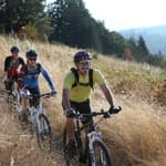
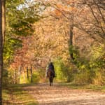
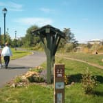
The Genesee Riverway Trail is an urban off-road trail along the Genesee River through the scenic, historic and cultural heart of Rochester, linking the (statewide) Erie Canal Heritage Trail, the Genesee Greenway Trail (Erie Canal to Pennsylvania), downtown Rochester and the Port of Rochester on Lake Ontario. The trail links 11 parks, (including 4 historic parks designed by Frederick Law Olmsted), the University of Rochester, and 9 historic districts. It provides public access to the river, including 7 pedestrian bridges, a scenic gorge, three waterfalls, an 1842 Erie Canal aqueduct and an 1822 Lake Ontario lighthouse. The trail links city neighborhoods, (with the lowest incomes and lowest rates of automobile ownership in the SMSA) with city attractions and services. To encourage and guide trail use, a system of 125 trail identification and wayfinding signs have been installed. In addition a trail brochure is published and distributed by the City. The trail is owned and maintained by the City of Rochester for public use. Support and collaboration from the citizen group, Friends of the Genesee Riverway Trail, the University of Rochester, Rochester Gas & Electric Co. and the County of Monroe have been significant. The trail is complete from the south city line to downtown on both sides of the river (9 miles). Between downtown and Lake Ontario, it is mostly complete (4 miles). An additional 2 miles, including a 2/3 mile long boardwalk along a dramatic gorge are under construction, to be completed in 2006.
Additional Details
Width: 120 inches.
Primary Surface: Asphalt
Secondary Surface: None
Average Grade: 3%
Maximum Grade: 10%
Elevation Low Point: 225
Elevation High Point: 512
Elevation Gain (cumulative): Not Available
Year Designated: 2006
Supporting Webpages and Documents
Map: Rochester's Trail GuideWebsite: City of Rochester Trail Information
Contact Information
For more information and current conditions, contact the trail manager (listed below). For questions, suggestions, and corrections to information listed on the website, contact American Trails.
Trail Management:
City of Rochester
City Hall, Room 300B
30 Church Street
Rochester, NY
14614
(585) 428-6601
[email protected]
http://www.cityofrochester.gov
Photos
No additional photos are available.Reviews
Suggest an Edit
Do you see a problem with this trail data? Contact us below: