Minnesota
Cannon Valley Trail
The Cannon Valley Trail is a 19.7 mile long trail that runs through diverse and spectacular scenery on a former Chicago Great Western Railroad line connecting the cities of Cannon Falls, Welch and Red Wing in beautiful southeastern Minnesota.
Loop Trail? No
Type: Rail Trail
Agency: Commission
Entry Fee? No
$4 for a Daily Wheel Pass or $25 for a Season Wheel Pass
Parking Fee? No Allowed Uses:
Bicycling (on pavement)
Bicycling (off pavement)
Roller/Inline Skating
Skateboarding
Snow - Cross-country Skiing
Snow - Snowshoeing
Wildlife Observation
Location: A Railtrail connecting the cities of Cannon Falls, Welch and Red Wing in beautiful southeastern Minnesota.
State(s): Minnesota
Counties: Goodhue
Longitude: -92.738461
Latitude: 44.563292
Driving Directions
Welch Station Access
26674 144th Avenue Way – Welch, MN 55089
From the Twin Cities– Take Hwy. 61 through Cottage Grove and take 316 out of Hastings. At 61 again, turn left and after a few miles take a right on County Road 7. Signs are posted. Follow Co. 7 straight into Welch. Welch Station Access is located about a quarter mile south past the village of Welch.
Description
The Cannon Valley Trail is a 19.7 mile long trail that runs through diverse and spectacular scenery on a former Chicago Great Western Railroad line connecting the cities of Cannon Falls, Welch and Red Wing in beautiful southeastern Minnesota.
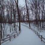
Paralleling the Cannon River, the Trail offers glimpses and panoramas of the valley and gradually descends 115 feet in elevation from Cannon Falls to Red Wing. From overhanging cliffs to views of extensive wetland complexes, nature’s seasonal changes are vividly displayed.
The Trail is open year round for bicycling, in-line skating, skateboarding, similar wheeled recreational devices, hiking and walking and cross country skiing. Trail users age 18 or older must have a valid Wheel Pass when using the trail from April 1st – November 1st. The Great Minnesota Ski Pass is required to cross-country ski on the Cannon Valley Trail.
Additional Details
Width: 96 inches.
Primary Surface: Asphalt
Secondary Surface: None
Average Grade: 1%
Maximum Grade: 2%
Elevation Low Point: 700
Elevation High Point: 815
Elevation Gain (cumulative): Not Available
Year Designated: 2018
Contact Information
For more information and current conditions, contact the trail manager (listed below). For questions, suggestions, and corrections to information listed on the website, contact American Trails.
Public Contact:
Scott Roepke
Trail Manager
Cannon Valley Trail Joint Powers Board
825 Cannon River Avenue
Cannon Falls, MN
55009
507-263-0508
[email protected]
Photos
Reviews
Suggest an Edit
Do you see a problem with this trail data? Contact us below: